Drone tracking at roundabouts
See the full picture from above. Understand how traffic flows through a roundabout: where vehicles enter, where they exit, and which movements dominate.
Vantage scores conflicts across every intersection and ranks your riskiest sites, so your team knows where to act.
View demo



Surface near-miss conflicts from survey video, scored by severity.
Every site banded worst-first on an exposure-weighted rate.
See where conflicts cluster, plotted on the aerial by user and severity.
Drill into proximity, severity and the full event log in a couple of clicks.

See the full picture from above. Understand how traffic flows through a roundabout: where vehicles enter, where they exit, and which movements dominate.
Go beyond flat 2D detections. Fixed-camera tracking with 3D bounding boxes captures each vehicle's size, orientation, and gap to nearby traffic, giving you the spatial detail needed for reliable safety analysis.
Maintain reliable vehicle tracks even when vehicles are partially or temporarily fully hidden from view. Gives you more trustworthy movement and safety insights from both fixed-camera and drone data in real-world conditions.
See traffic analysis as it happens. Run live tracking on a fixed camera feed and get instant insight into how vehicles are moving across your network.
Capture complex risk in a single scene, including a U-turn, an illegal left turn, and strong sun glare. Show how the platform still identifies unsafe interactions and near-miss conditions even when visibility is difficult.
Pinpoint locations where drivers brake hard and following traffic is put at risk. Find problem spots on your network before they become crash sites.
Find where drivers follow too closely for the conditions. Highlight corridors and locations with unsafe following behaviour.
Automatically detect vehicles making prohibited manoeuvres. See exactly what happened, where, and how often, without manual video review.
Understand how closely road users pass through the same space at junctions and crossings. Reveal near-misses that never appear in crash records.
Identify the highest-risk interactions on your network: moments where a collision was narrowly avoided. Prioritise safety improvements where they matter most.
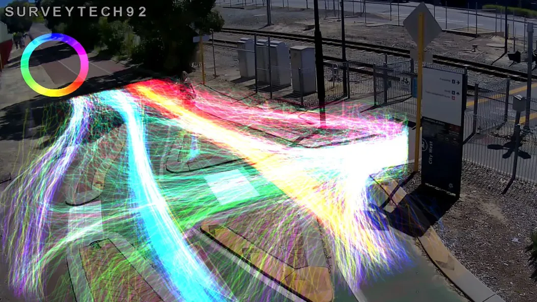
Reveal how pedestrians, cyclists, and e-rideable users move through parks, paths, and intersections. See the routes people choose, including informal crossings and shortcuts that infrastructure plans often miss.
Slide 1 of 5